The Australian Transport Safety Bureau did not conduct an on scene investigation of this occurrence. The report presented below was derived from information supplied to the Bureau.
On 8 March 2004 at about 1550 Eastern Summer Time, a glider impacted the ground in Western Victoria. The pilot was fatally injured. Following the accident, the Victorian Coroner's office forwarded a global positioning system (GPS) navigation unit and a data logging unit from the glider to the Bureau for examination.
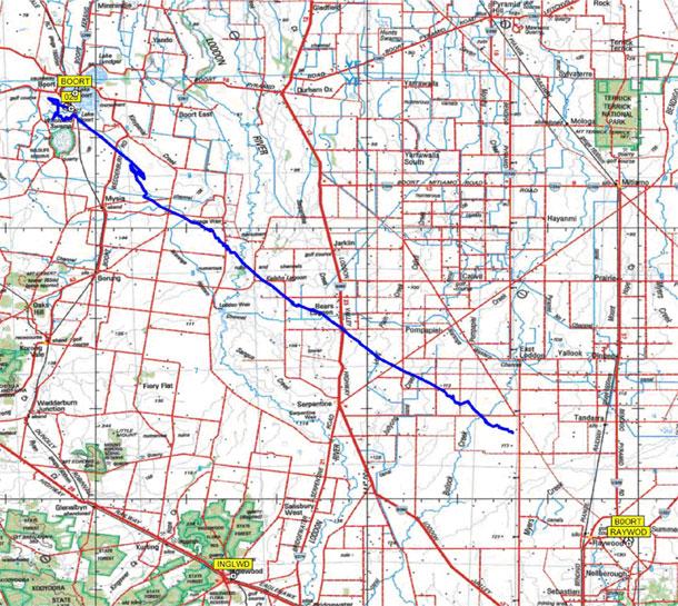
The GPS unit was able to be interrogated and data for the accident flight was downloaded (Fig 1). The data recovered from the GPS showed that the glider departed from Boort and appeared to be tracking towards Raywood. The track stopped at a position coincident with the reported accident site.
No altitude data was recorded by the GPS unit, therefore only the track of the glider was able to be displayed on a map.
The data logging unit sustained impact damage. The unit was connected to a computer with the applicable interrogation software installed. However, when an attempt was made to download the data, the unit returned an error signal, and no data was able to be downloaded.


