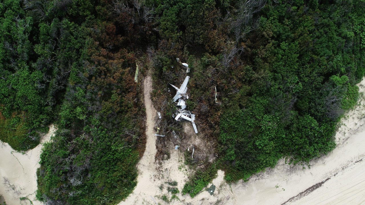
The ATSB has released a preliminary report from its ongoing investigation into the collision with terrain of a twin-engined Cessna 404 Titan aircraft near Lockhart River, Queensland on 11 March, in which the pilot and four passengers on board lost their lives.
The preliminary report details factual information established in the investigation’s early evidence collection phase, including the accident’s sequence of events derived from the aircraft’s track and altitude, information determined from examining the wreckage and impact site, and weather details.
The Cessna had departed Cairns at 7:19am for a planned same-day return charter flight to Lockhart River, the report notes. The forecast weather for their arrival at Lockhart River was for overlapping periods of rain and low cloud with possible thunderstorms.
ATSB Executive Director Transport Safety Nat Nagy said investigators were able to build an understanding of the aircraft’s flightpath using transmitted GPS data recorded at five-second intervals by an electronic flight bag application on the pilot’s iPad.
That data showed that the pilot was conducting an area navigation (RNAV) GPS instrument approach using track and distance data from satellite navigation receivers to try and land at Lockhart River. For vertical navigation the pilot was using a combination of altimeter and GPS distance information.
Tragically, the descent continued until the aircraft impacted a sand dune on the coast, fatally injuring all on board.
“When the aircraft was about 30 km from Lockhart River, the pilot joined the approach and followed the procedure down to the missed approach waypoint. The pilot continued to track to the runway and operated below the minimum descent altitude (MDA) for a short period until the pilot initiated a missed approach,” Mr Nagy said.
The aircraft climbed to 3,500 feet and tracked for a second GPS approach.
“When flying a GPS approach, the minimum safe altitude progressively steps down between waypoints as the aircraft gets closer to the runway,” Mr Nagy explained.
Halfway along the approach, the aircraft descended through the minimum safe altitude of 1,800 feet for that segment. About 30 seconds after the final approach fix, the data shows the aircraft nearing 700 feet with an apparent decrease in the descent rate for a short period. The aircraft then descended below the minimum descent altitude and diverged to the left, crossing the inbound track at an angle of about 20°.
“Tragically, the descent continued until the aircraft impacted a sand dune on the coast, fatally injuring all on board,” Mr Nagy said.
The accident site was located on a sand bank adjacent to the beach, about 6 kilometres south-east of Lockhart River Aerodrome and 300 metres to the south-west of the specified RNAV approach track, Mr Nagy explained.
“Examination of the wreckage indicated that both engines were operating normally with substantial power on impact and that the landing gear was extended. There was no evidence of any structural or mechanical defects with the aircraft.”
Mr Nagy noted that ATSB preliminary reports do not contain findings, identify contributing factors or outline safety issues and actions, which will be detailed in the investigation’s final report.
“As the investigation continues, the ATSB will continue its analysis of recorded flight data and weather conditions,” he said.
“We will also examine the operation of the aircraft’s Garmin GNS 430W avionics units; the training and checking processes for RNAV approaches, including missed and subsequent approaches; and look at existing and potential risk controls for controlled flight into terrain, noting that the aircraft was not fitted with, nor was it required to be, an enhanced ground proximity warning system.”
Mr Nagy also noted that the aircraft was not fitted with a cockpit voice recorder or a flight data recorder, but nor was it required to be.
Read the preliminary report: Controlled flight into terrain involving Cessna 404, VH-OZO, Lockhart River, Queensland, on 11 March 2020


